As ever I do love a good list. Below are my favourite Andros Routes walks with a bit about why I like them so much and photos/videos of what they look like.
Try them out for yourself and see what you think!
(P.s. make sure to buy the latest Andros Routes map as each year a new edition is published with new routes and some of the older editions may not include the routes below)
1. Andros Route Number 14. The Frousei watermills
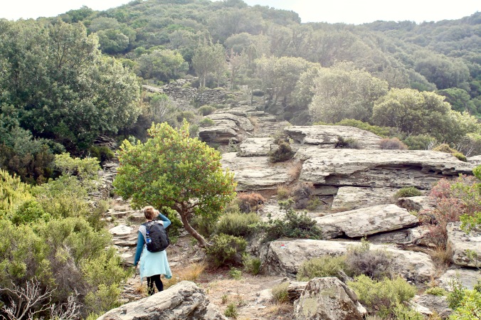
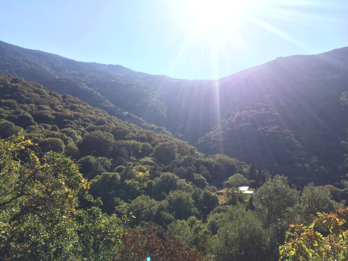
Now I may be somewhat biased here as this is a route my father opened up however I know many other (non-biased) people that feel the untouched natural wilderness that befalls the Frousei valley makes this their favourite route too! Originally this valley was occupied by many families living next to the river making a living from watermills. Indeed my father remembered as a child bringing sacks of grain on donkey-back from his village to turn it into flour here. For decades however the valley has been uninhabited and largely inaccessible until Andros Routes developed this path. The mill buildings lie in ruins and nature has taken over it in the most beautiful way. This route is a must if you are new to Andros Routes. Taking photos never seems to do this place justice, it has to be seen to fully appreciate why this is a favourite.
Note: The section of route 14. that I am referring to as my favourite is specifically the Frousei valley (look for the watermill symbols on the Andros routes map). The connecting section to Gavrio is good for hiking but nowhere near as breathtaking.
2. Ar1. Arni Circular
When I first visited Arni, it felt like I had inadvertently stepped out into a little alpine mountain village. Indeed it has been referred to as ‘Little Switzerland’. It is a stark contrast to much of the arid shrubland seen in the Cyclades. The Ar1 circular route covers a nice section of this verdant valley and the many trees and streams offer a refreshing break from the hot Mediterranean climate.
Here is a short little video of the route taken in the Autumn of 2017. Ahhhhh bliss!
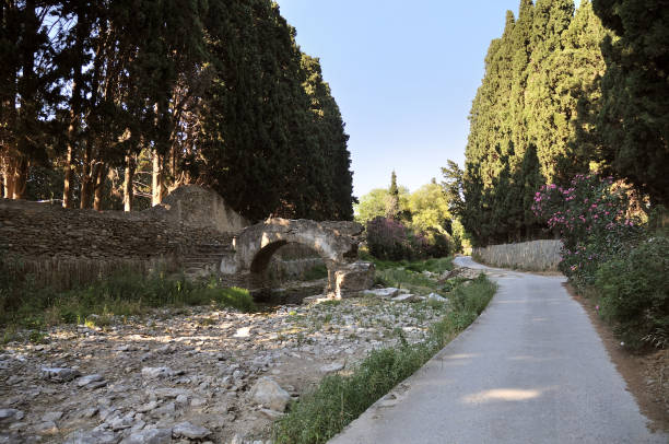
3. Andros Route Number 17. Chora – Livadia Circular
This easy walk which starts in the capital Chora and passes through the village of Livadia and others before looping back to the start is a must if you are visiting the capital of the island. The route takes you through the flat lands surrounding Chora, past many of the old wealthy estates in which citrus and cypress trees grow in abundance. Peering over the walls offers a glimpse of what life looked like when Andros was once successful on the world stage due to it’s prolific shipping trade. This is a lovely way to spend an afternoon and I highly recommend this route!
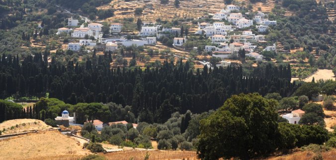
Livadia seen from above
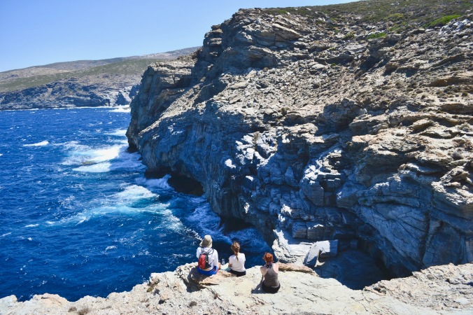
4. Andros Route Number 20. Zorgos – Trypes Cave
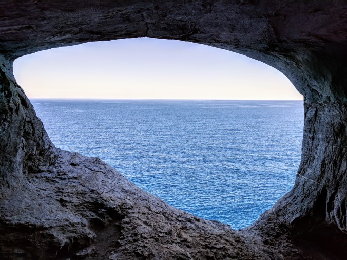
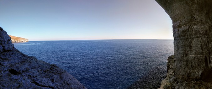
Route 20. is relatively short and relatively easy. At first unremarkable, it’s secret is only revealed at the end! It starts at Zorgos beach which is a fantastic place for a swim. After 45 minutes or so following the signposted path, it takes a turn inland and a hole appears in the ground into which you can climb down without much difficulty. What is then revealed is an amazing cave complex with incredible views out to sea. Once again, it needs to be seen to be fully appreciated.
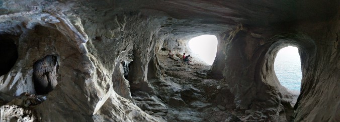
Panoramic view of the Trypes cave complex
Admiring the coast on Route. 20
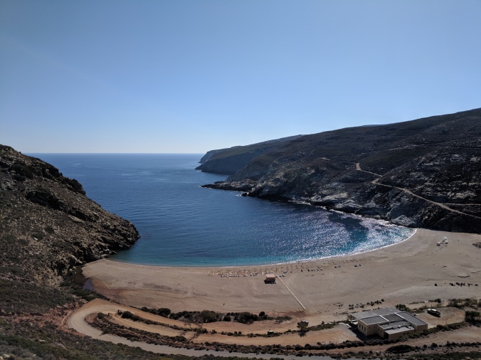
Zorgos beach at the start (and finish) of Route 20.
Below is a video of Route. 20 with an extra section to the utterly stunning Microgiali beach.
5. Andros Route Number 19
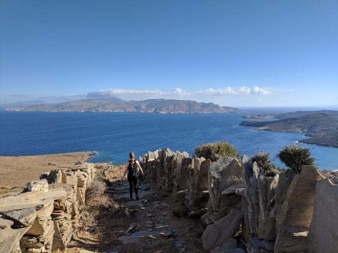
Descending towards Stavros beach on route 19.
I like this route because it is tough! Route number 19. ascends Andros’ southerly most ridge twice (as you have to return to it’s starting point off route number 4). It explores the mostly uninhabited southern part of the island which is home primarily to flocks of sheep & goats. The route descends to the southern tip of Andros at the beach of Stavros. You are 99.9% guaranteed to have this marvellous little beach to yourself as there aren’t any roads to it and very few people venture to this side of the island. Expect plenty of climbing uphill and if it is hot, bring plenty of water. The little oasis of Stravros beach at the bottom makes the slog worthwhile.
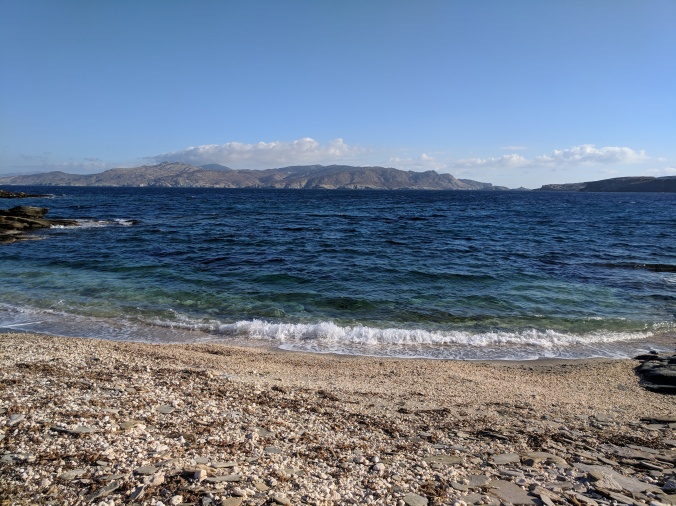
Stavros beach
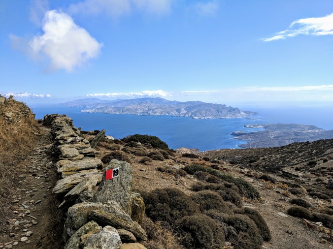
Tinos island seen in the distance
If you are walking in Autumn you may see the plentiful Saffron crocuses higher up at the ridge flowering in abundance with their expensive stamens feeding nothing but the bees.
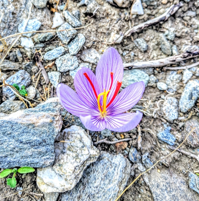
The worlds most expensive spice (Saffron) growing wild
Thanks for stopping by!

Hello Andreas
Thanks for all your informative work on this blog
I’d like to try the climb from Palaiopoli to Mount Kouvara. Elsewhere you say that there’s no real track. Can it be climbed just by instinct? I watched your video of it, and it looks as though it involves some scrambling and ledge-walking. I’m prepared to do this kind of thing. Would you be able to hazard some kind of directions?
With thanks and regards
LikeLiked by 1 person
Hi Jim, thanks, glad you found it useful!
Good choice, it is an impressive route. If you use Strava, here is the route (https://www.strava.com/activities/1023836328). Just like you have suggested, there isn’t an obvious route, so it is a bit instinctive. Head up from the main road using the white staircase to Agios Ioannis (church). From there just keep heading up to higher ground. If you look upwards to the ridge you may be able to see the track of the small river, this is what you want to intercept eventually as you will go past an impressive waterfall eventually. You then gradually head diagonally left up towards the summit, again no path just head intuitively for the summit. If you drop me an email at “andreastridimas@hotmail.co.uk” I would be happy to share the gpx file of the route I took.
All the best, Andreas
LikeLike
Thanks Andreas for your reply
The route in the link you posted makes it look as though you went straight up the ravine directly above Ag. Ioannis(!!), then over the hump between it and the ravine just north of west and to the summit from the western flank of that second ravine. Or have I read the map wrong? If you did it that way I reckon I might struggle to replicate your route, since the ravine above Ag. Ioannis looks *extremely* steep.
Is the river-course you mentioned above in the ravine above Ag. Ioannis, or is it in the second ravine, to the west?
How long from Ag. Saranta do you reckon it would take to reach the 994 metre mark (Petalon on the Strava map)?
Have just sent you an email
With thanks again
Jim
LikeLiked by 1 person